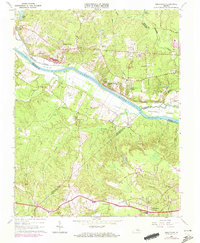
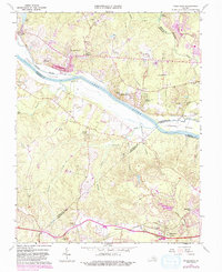
1964 Map of Midlothian
USGS Topo · Published 1972About this map
The James River carves a deep boundary through this landscape, separating Goochland, Henrico, and Powhatan counties as it flows past Sabot Little River Island and Tuckahoe Island. During the mid-1960s, this region maintained a mix of historic rural settlements and emerging country clubs, including the Richmond Country Club and Oak Hill Country Club. In the north, the Chesapeake and Ohio railroad corridor follows the river's path through Manakin and Vinita, while the southern portion of the map is anchored by the village of Midlothian along the Southern railroad line.
Find a feature on this map
52 named features on this map. Tap any name to fly to it.
Don’t see what you’re looking for? This feature index may not catch every label — zoom into the map to look around manually.
Map Details
Editions of this 1964 Midlothian Map
5 editions found
Other maps of this area

1890 · Goochland
USGS Topo · 1:125,000

1892 · Goochland
USGS Topo · 1:125,000

1897 · Amelia
USGS Topo · 1:125,000

1936 · Richmond West
USGS Topo · 1:24,000

1936 · Glen Allen
USGS Topo · 1:24,000

1941 · Glen Allen
USGS Topo · 1:31,680

1942 · Westhampton
USGS Topo · 1:31,680

1943 · Fine Creek Mills
USGS Topo · 1:31,680

1943 · Chesterfield
USGS Topo · 1:31,680

1943 · Perkinsville
USGS Topo · 1:31,680