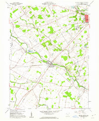
1961 Map of Milford Center
USGS Topo · Published 1962About this map
Milford Center serves as the focal point of this 1961 Union County survey, situated at the confluence of the Pennsylvania railroad and the winding Big Darby Creek. The landscape reflects a mix of mid-century civic infrastructure and agrarian roots, featuring the State Reformatory for Women and a Drive-in Theater just outside Marysville. Genealogists will find a high density of burial grounds throughout the townships, including Oakdale Cemetery, Buck Run Cem, and the Robinson Cem.
Find a feature on this map
40 named features on this map. Tap any name to fly to it.
Don’t see what you’re looking for? This feature index may not catch every label — zoom into the map to look around manually.
Map Details
Editions of this 1961 Milford Center Map
Other maps of this area

1913 · East Liberty
USGS Topo · 1:62,500

1913 · Richwood
USGS Topo · 1:62,500

1914 · Mechanicsburg
USGS Topo · 1:62,500

1915 · Richwood
USGS Topo · 1:62,500

1915 · East Liberty
USGS Topo · 1:62,500

1916 · Mechanicsburg
USGS Topo · 1:62,500

1916 · Milford Center
USGS Topo · 1:62,500

1944 · East Liberty
USGS Topo · 1:62,500

1944 · Mechanicsburg
USGS Topo · 1:62,500

1944 · Richwood
USGS Topo · 1:62,500