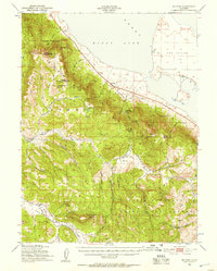
1950 Map of Milford
USGS Topo · Published 1957About this map
Honey Lake dominates the northeastern corner of this 1950s survey, its shoreline abutting the small settlement of Milford and the distinctive landform of The Island. The landscape transitions abruptly from the lake basin into the high elevations of the Lassen National Forest and Plumas National Forest. Industrial and agricultural activity is evident through features like the Honey Lake Mine and the Squaw Valley Logging Railroad, which traces a path through the southern valleys near Squaw Valley Peak.
Find a feature on this map
45 named features on this map. Tap any name to fly to it.
Don’t see what you’re looking for? This feature index may not catch every label — zoom into the map to look around manually.
Map Details
Editions of this 1950 Milford Map
3 editions found

Other maps of this area

1886 · Honey Lake
USGS Topo · 1:250,000

1890 · Sierraville
USGS Topo · 1:125,000

1891 · Downieville
USGS Topo · 1:125,000

1891 · Honey Lake
USGS Topo · 1:250,000

1892 · Sierraville
USGS Topo · 1:125,000

1893 · Honey Lake
USGS Topo · 1:250,000

1893 · Downieville
USGS Topo · 1:125,000

1894 · Sierraville
USGS Topo · 1:125,000

1895 · Downieville
USGS Topo · 1:125,000

1896 · Downieville
USGS Topo · 1:125,000