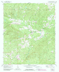
1969 Map of Millerville
USGS Topo · Published 1989About this map
Millerville sits at the heart of this rural Clay County landscape, where the foothills of the Appalachian range meet a dense network of creek valleys. The settlement pattern is defined by small community hubs centered on local congregations and educational landmarks, such as Graves High Sch and Mt Tabor Ch. Significant portions of the northern terrain are protected within the Talladega National Forest, featuring prominent heights like Backbone Mountain and Dugout Mtn.
Find a feature on this map
41 named features on this map. Tap any name to fly to it.
Don’t see what you’re looking for? This feature index may not catch every label — zoom into the map to look around manually.
Map Details
Editions of this 1969 Millerville Map
3 editions found
Other maps of this area

1890 · Talladega
USGS Topo · 1:125,000

1891 · Ashland
USGS Topo · 1:125,000

1892 · Talladega
USGS Topo · 1:125,000

1943 · Talladega
USGS Topo · 1:62,500

1944 · Goodwater
USGS Topo · 1:62,500

1946 · Talladega
USGS Topo · 1:62,500

1947 · Goodwater
USGS Topo · 1:62,500

1953 · Birmingham
USGS Topo · 1:250,000

1953 · Atlanta
USGS Topo · 1:250,000

1956 · Birmingham
USGS Topo · 1:250,000