
1965 Map of Millis
USGS Topo · Published 1968About this map
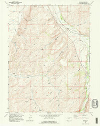
Emigrant Trail routes dominate this mid-1960s landscape, cutting across a terrain defined by deep hollows and high ridges. The Emigrant Stagecoach Trail is clearly delineated alongside a modern Historical Marker, preserving the memory of westward expansion as it intersected the Bear River valley. This area shows a layering of transportation history, where the industrial presence of the Union Pacific railroad and an Old Railroad Grade run parallel to older pioneer paths. Utility and water management are prominent through labels for the Evanston Pumping Sta and a network of ditches, including the City Ditch and Old City Ditch. Family-named geographic features like Glasscock Hollow, Knight Hollow, and Bernard Hollow offer valuable clues for genealogical research in this part of Uinta County.
Find a feature on this map
32 named features on this map. Tap any name to fly to it.
Don’t see what you’re looking for? This feature index may not catch every label — zoom into the map to look around manually.
Map Details
Editions of this 1965 Millis Map
2 editions found
Other maps of this area

1954 · Ogden
USGS Topo · 1:250,000

1958 · Ogden
USGS Topo · 1:250,000

1960 · Ogden
USGS Topo · 1:250,000

1965 · Evanston
USGS Topo · 1:24,000

1965 · Myers Reservoir
USGS Topo · 1:24,000

1965 · Sulphur Creek Reservoir
USGS Topo · 1:24,000

1965 · Guild Hollow
USGS Topo · 1:24,000
1965 · Pine Knoll
USGS Topo · 1:24,000

1968 · Wahsatch
USGS Topo · 1:24,000
1968 · Porcupine Ridge
USGS Topo · 1:24,000