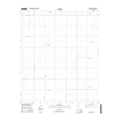
2017 Map of Milnesand NW
USGS Topo · Published 2017About this map
Eagle Hill Cem is the primary landmark in this remote corner of Roosevelt County, situated near the intersection of S Roosevelt Road Z and S Roosevelt Road 41. The landscape is defined by the rigid geometry of the Public Land Survey System, with township and range lines such as t7s r34e and t8s r35e carving the high plains into a disciplined grid. A network of rural routes, including S Roosevelt Road 35 and S Roosevelt Road 37, provides access to these agricultural lands. This survey reflects the enduring character of the Llano Estacado, where the vast open spaces are punctuated only by seasonal water features and the occasional isolated cemetery, preserving a record of the early settlers who established this high-plains infrastructure.
Find a feature on this map
15 named features on this map. Tap any name to fly to it.
Don’t see what you’re looking for? This feature index may not catch every label — zoom into the map to look around manually.
Map Details
Editions of this 2017 Milnesand NW Map
This is the sole edition of this map. No revisions or reprints were ever made.
Other maps of this area

1954 · Brownfield
USGS Topo · 1:250,000

1958 · Brownfield
USGS Topo · 1:250,000

1962 · Brownfield
USGS Topo · 1:250,000

1972 · Milnesand SW
USGS Topo · 1:24,000

1972 · Milnesand
USGS Topo · 1:24,000

1972 · Dora SW
USGS Topo · 1:24,000

1972 · Crossroads
USGS Topo · 1:24,000
1972 · Pep
USGS Topo · 1:24,000
1972 · Milnesand NW
USGS Topo · 1:24,000

1978 · Flying M Ranch
USGS Topo · 1:24,000