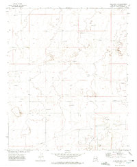
1972 Map of Milnesand NW
USGS Topo · Published 1975About this map
The high plains of Roosevelt County are defined here by a sprawling landscape of energy extraction and mineral production as it appeared in the early 1970s. The topography is dominated by the Chaveroo Oil Field and the Milnesand Oil Field, characterized by a dense network of drill holes and oil wells. A significant industrial Pipeline traverses the southern half of the quadrangle, reflecting the region's mid-century economic reliance on petroleum resources.
Find a feature on this map
5 named features on this map. Tap any name to fly to it.
Don’t see what you’re looking for? This feature index may not catch every label — zoom into the map to look around manually.
Map Details
Editions of this 1972 Milnesand NW Map
2 editions found
Other maps of this area

1954 · Brownfield
USGS Topo · 1:250,000

1958 · Brownfield
USGS Topo · 1:250,000

1962 · Brownfield
USGS Topo · 1:250,000

1972 · Milnesand SW
USGS Topo · 1:24,000

1972 · Milnesand
USGS Topo · 1:24,000

1972 · Dora SW
USGS Topo · 1:24,000

1972 · Crossroads
USGS Topo · 1:24,000
1972 · Pep
USGS Topo · 1:24,000

1978 · Flying M Ranch
USGS Topo · 1:24,000
1979 · Elida SE
USGS Topo · 1:24,000