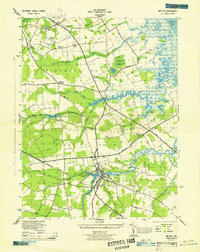
1944 Map of Milton
USGS Topo · Published 1944About this map
Milton serves as the focal point of this Delaware coastal survey, situated where the Broadkill River meets the tidal marshlands of the Delaware Bay. The landscape is defined by its "necks"—narrow strips of land between waterways—including Slaughter Neck, Primehook Neck, and Cave Neck. This geography dictated the placement of early settlements and agricultural crossroads like Jefferson Crossroads and Anderson Crossroads. The map reveals a robust rural community established around localized industry and faith, evidenced by sites like Reynolds Mill and numerous ecclesiastical landmarks such as Westley Chapel, Bethel Church, and the Pilgrims Progress Tabernacle. Transportation is anchored by the Pennsylvania Railroad, which cuts through the heart of the region. The interior is a intricate web of freshwater runs and ponds, including Waples Pond and Paynters Pond, which drain through the salt marshes of Roach Marsh and Reed Marsh toward the coast.
Find a feature on this map
60 named features on this map. Tap any name to fly to it.
Don’t see what you’re looking for? This feature index may not catch every label — zoom into the map to look around manually.
Map Details
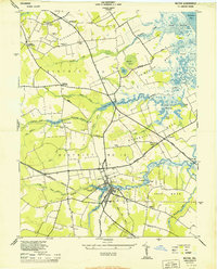
Editions of this 1944 Milton Map
2 editions found
Other maps of this area

1917 · Millsboro
USGS Topo · 1:62,500

1918 · Cedar Creek
USGS Topo · 1:62,500

1918 · Rehoboth
USGS Topo · 1:62,500

1918 · Cape Henlopen
USGS Topo · 1:62,500

1919 · Cedar Creek
USGS Topo · 1:62,500

1937 · Cape Henlopen
USGS Topo · 1:62,500

1938 · Cedar Creek
USGS Topo · 1:62,500

1938 · Millsboro
USGS Topo · 1:62,500

1938 · Rehoboth
USGS Topo · 1:62,500

1943 · Fairmount
USGS Topo · 1:24,000