
1954 Map of Milwaukee
USGS Topo · Published 1967About this map
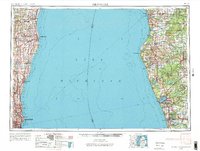
Lake Michigan dominates this mid-century survey, acting as the great connector between the industrial centers of Wisconsin and the timber and port towns of Michigan. On the western shore, the expanding urban footprint of Milwaukee is documented alongside its neighboring communities like Wauwatosa and Shorewood. To the north, the shoreline passes through Sheboygan and the harbor at Port Washington, where a prominent Power plant stands. Across the water, the Michigan coastline is defined by its numerous inland lakes and the protected expanse of the Manistee National Forest. Industrial and maritime activity is evident in the rail networks of the Chesapeake & Ohio and Grand Trunk Western, which serviced major ports such as Muskegon and Ludington. The map provides a clear view of the region's transport-oriented development, from the busy waters of Milwaukee Bay to the prominent navigational landmark at Little Sable Point.
Find a feature on this map
64 named features on this map. Tap any name to fly to it.
Don’t see what you’re looking for? This feature index may not catch every label — zoom into the map to look around manually.
Map Details
Editions of this 1954 Milwaukee Map
3 editions found

Other maps of this area

1891 · Bayview
USGS Topo · 1:62,500

1891 · Muskego
USGS Topo · 1:62,500

1892 · Milwaukee
USGS Topo · 1:62,500

1892 · Waukesha
USGS Topo · 1:62,500

1892 · Port Washington
USGS Topo · 1:62,500

1901 · Milwaukee
USGS Topo · 1:62,500

1901 · Waukesha
USGS Topo · 1:62,500

1901 · Bayview
USGS Topo · 1:62,500

1901 · Muskego
USGS Topo · 1:62,500

1904 · West Bend
USGS Topo · 1:62,500