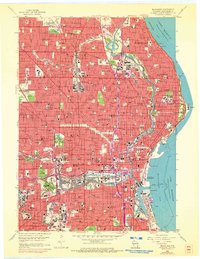
1958 Map of Milwaukee
USGS Topo · Published 1972About this map
Milwaukee and its lakefront suburbs are shown here in the late 1950s, revealing a dense urban grid heavily influenced by industrial and transport corridors. The meeting of the Milwaukee River, Menomonee River, and Kinnickinnic River forms the city's commercial heart, where landmarks like City Hall and the Municipal Pier anchor the downtown and harbor. Significant industrial activity is evident along Jones Island, home to the Sewage Disposal plant and extensive rail yards of the Milwaukee Road.
Find a feature on this map
245 named features on this map. Tap any name to fly to it.
Don’t see what you’re looking for? This feature index may not catch every label — zoom into the map to look around manually.
Map Details
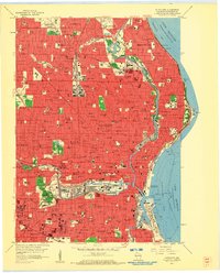
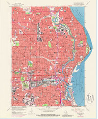
Editions of this 1958 Milwaukee Map
3 editions found
Other maps of this area

1891 · Bayview
USGS Topo · 1:62,500

1891 · Muskego
USGS Topo · 1:62,500

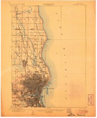
1892 · Milwaukee
USGS Topo · 1:62,500

1892 · Waukesha
USGS Topo · 1:62,500

1901 · Milwaukee
USGS Topo · 1:62,500

1901 · Waukesha
USGS Topo · 1:62,500

1901 · Bayview
USGS Topo · 1:62,500

1901 · Muskego
USGS Topo · 1:62,500

1906 · Waukesha
USGS Topo · 1:62,500
1906 · Milwaukee
USGS Topo · 1:62,500