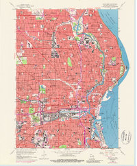
1958 Map of Milwaukee
USGS Topo · Published 1988About this map
Milwaukee’s lakeside industrial and residential landscape is captured here during a period of significant urban transit expansion, notably shown by the newly developing Stadium Freeway corridor. The map highlights the city's academic and civic core, from Marquette University near the downtown district to the Univ of Wisconsin at Milwaukee and Milwaukee Downer College further north. Public spaces and landmarks like County Stadium and the Municipal Pier illustrate the city's mid-century recreational life along Lake Michigan.
Find a feature on this map
166 named features on this map. Tap any name to fly to it.
Don’t see what you’re looking for? This feature index may not catch every label — zoom into the map to look around manually.
Map Details
Editions of this 1958 Milwaukee Map
3 editions found
Other maps of this area

1891 · Bayview
USGS Topo · 1:62,500

1891 · Muskego
USGS Topo · 1:62,500

1892 · Milwaukee
USGS Topo · 1:62,500

1892 · Waukesha
USGS Topo · 1:62,500

1901 · Milwaukee
USGS Topo · 1:62,500

1901 · Waukesha
USGS Topo · 1:62,500

1901 · Bayview
USGS Topo · 1:62,500

1901 · Muskego
USGS Topo · 1:62,500

1906 · Waukesha
USGS Topo · 1:62,500

1906 · Milwaukee
USGS Topo · 1:62,500