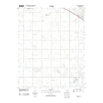
2009 Map of Minco NE
USGS Topo · Published 2009About this map
Clarence E Page Municipal Airport and the surrounding rural-suburban landscape west of Oklahoma City define this transition in the late 2000s. The map reveals a highly structured grid of section lines and residential developments, including the Forehand Cemetery north of W Reno Ave. Water management is a primary feature of the local topography, evidenced by several small reservoirs and engineered structures such as Jacobs Acres Lake and Lakehoma Acres Lake, both maintained by named earthen dams. These drainages, including Shell Creek and Foreman Creek, flow through a region increasingly shaped by local road expansion like W Vandament Ave and S Frisco Rd. For those researching local property history, the map provides precise locations for family-named water bodies and minor watercourse crossings like Bennett Creek.
Find a feature on this map
46 named features on this map. Tap any name to fly to it.
Don’t see what you’re looking for? This feature index may not catch every label — zoom into the map to look around manually.
Map Details
Editions of this 2009 Minco NE Map
This is the sole edition of this map. No revisions or reprints were ever made.
Other maps of this area

1892 · Kingfisher
USGS Topo · 1:125,000

1893 · Oklahoma City
USGS Topo · 1:62,500

1893 · Minco
USGS Topo · 1:62,500

1895 · Kingfisher
USGS Topo · 1:125,000

1904 · Chickasha
USGS Topo · 1:125,000

1954 · Oklahoma City
USGS Topo · 1:250,000

1956 · Oklahoma City
USGS Topo · 1:62,500

1957 · Oklahoma City
USGS Topo · 1:250,000

1963 · Oklahoma City
USGS Topo · 1:250,000
1965 · Oklahoma City SW
USGS Topo · 1:24,000