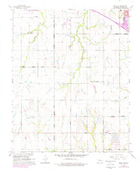
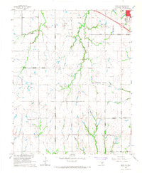
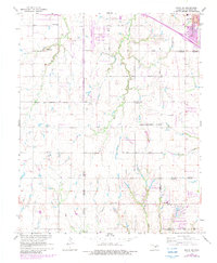
1966 Map of Minco NE
USGS Topo · Published 1976About this map
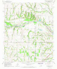
Cimarron Field and its associated heliport sit at the center of this mid-century survey, surrounded by the evolving rural and suburban boundaries of El Reno, Yukon, and Oklahoma City. The landscape is a transition from agricultural acreage to expanding residential zones, marked by a regular grid of section roads like NW 10th Street and West Reno Avenue. Local history is anchored by the Forehand Cemetery and the Banner School in the northwest, alongside several churches including West Point Church and Chisholm Church. Small watercourses like Shell Creek and Purcell Creek cut through the terrain, while the developing community of Mustang begins to take shape in the southeast corner. Photorevisions from 1975 highlight the rapid suburban growth and infrastructure changes occurring around the fringe of the metropolitan area.
Find a feature on this map
37 named features on this map. Tap any name to fly to it.
Don’t see what you’re looking for? This feature index may not catch every label — zoom into the map to look around manually.
Map Details
Editions of this 1966 Minco NE Map
3 editions found
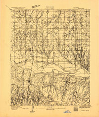
Other maps of this area

1892 · Kingfisher
USGS Topo · 1:125,000

1893 · Oklahoma City
USGS Topo · 1:62,500
1893 · Minco
USGS Topo · 1:62,500

1895 · Kingfisher
USGS Topo · 1:125,000

1904 · Chickasha
USGS Topo · 1:125,000

1954 · Oklahoma City
USGS Topo · 1:250,000

1956 · Oklahoma City
USGS Topo · 1:62,500

1957 · Oklahoma City
USGS Topo · 1:250,000

1963 · Oklahoma City
USGS Topo · 1:250,000
1965 · Oklahoma City SW
USGS Topo · 1:24,000