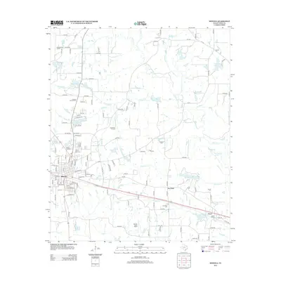
2012 Map of Mineola
USGS Topo · Published 2012About this map
The town of Mineola and its surrounding Wood County landscape are defined by a complex network of creeks and small lakes, most notably the Lake Fork Cr and its tributaries like Twomile Br and Rock Falls Cr. In this 2012 depiction, the community shows its development through a series of planned residential loops and several small airfields, including the Wood County Airport and Creekside Air Park. Genealogists will find a wealth of local history in the numerous burial grounds documented here, such as Roselawn Memorial Cem, Rockfield Cem, and Dumas Cem. The Union Pacific RR cuts through the southern portion of the quadrangle, passing through the settlements of New Hope and Hoard, where the Hoard Siding remains a point of interest for those tracking the region's rail-dependent logistics and development.
Find a feature on this map
140 named features on this map. Tap any name to fly to it.
Don’t see what you’re looking for? This feature index may not catch every label — zoom into the map to look around manually.
Map Details
Editions of this 2012 Mineola Map
This is the sole edition of this map. No revisions or reprints were ever made.
Other maps of this area

1956 · Tyler
USGS Topo · 1:250,000

1959 · Calvary
USGS Topo · 1:24,000

1959 · Golden
USGS Topo · 1:24,000

1959 · Van Lake
USGS Topo · 1:24,000

1959 · Grand Saline
USGS Topo · 1:62,500

1959 · Alba
USGS Topo · 1:62,500

1960 · Hainesville
USGS Topo · 1:24,000

1960 · Lindale
USGS Topo · 1:24,000

1960 · Mineola
USGS Topo · 1:24,000

1960 · Cartwright
USGS Topo · 1:24,000