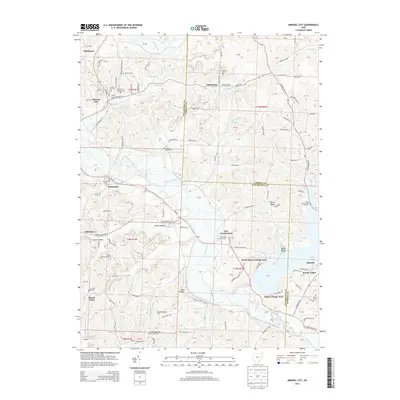
2013 Map of Mineral City
USGS Topo · Published 2013About this map
Mineral City and its surrounding hill country occupy a complex landscape where the Wheeling and Lake Erie railroad tracks follow the winding course of Huff Run. The map detail reveals a high concentration of burial grounds, from the Mineral City Catholic Cem to the isolated Harmony Cem, reflecting the early pioneer and ethnic settlement patterns across the Tuscarawas and Carroll County border. To the south, the waters of Atwood Lake and the Indian Fork have created a recreation-focused geography, evidenced by the North Shore Cottage Area and Glens Cottage Area. These lakeside developments contrast with the traditional farming and mining hamlets like Somerdale, Lindentree, and New Cumberland, providing a detailed look at how the region's economy shifted from extraction and agriculture toward twentieth-century water management and seasonal residency.
Find a feature on this map
102 named features on this map. Tap any name to fly to it.
Don’t see what you’re looking for? This feature index may not catch every label — zoom into the map to look around manually.
Map Details
Editions of this 2013 Mineral City Map
This is the sole edition of this map. No revisions or reprints were ever made.
Other maps of this area

1902 · Scio
USGS Topo · 1:62,500

1904 · Scio
USGS Topo · 1:62,500

1909 · Uhrichsville
USGS Topo · 1:62,500

1910 · Carrollton
USGS Topo · 1:62,500

1911 · Uhrichsville
USGS Topo · 1:62,500

1912 · Dover
USGS Topo · 1:62,500

1912 · Carrollton
USGS Topo · 1:62,500

1944 · Dover
USGS Topo · 1:62,500

1951 · Canton
USGS Topo · 1:250,000

1951 · Bolivar
USGS Topo · 1:24,000