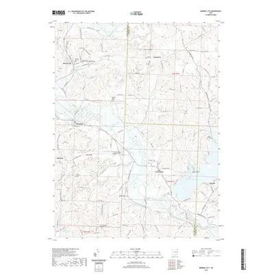
2019 Map of Mineral City
USGS Topo · Published 2019About this map
Mineral City sits at the northern edge of this landscape, where Huff Run winds through the hills of Tuscarawas and Carroll Counties. The region is defined by its deep spiritual and community roots, evidenced by the high density of burial grounds such as the Mineral City Catholic Cem and the Holmes Methodist Episcopal Cem. Waterways like Conotton Creek and Sandy Creek carve the valley floors, providing a natural framework for the scattered settlements of Somerdale, New Cumberland, and Lindentree. To the southeast, the geography shifts toward recreation and conservation around the shores of Atwood Lake. This 2019 survey documents a modern rural environment where historic township lines and small-town footprints remain the primary organizing features of the land.
Find a feature on this map
127 named features on this map. Tap any name to fly to it.
Don’t see what you’re looking for? This feature index may not catch every label — zoom into the map to look around manually.
Map Details
Editions of this 2019 Mineral City Map
This is the sole edition of this map. No revisions or reprints were ever made.
Other maps of this area

1902 · Scio
USGS Topo · 1:62,500

1904 · Scio
USGS Topo · 1:62,500

1909 · Uhrichsville
USGS Topo · 1:62,500

1910 · Carrollton
USGS Topo · 1:62,500

1911 · Uhrichsville
USGS Topo · 1:62,500

1912 · Dover
USGS Topo · 1:62,500

1912 · Carrollton
USGS Topo · 1:62,500

1944 · Dover
USGS Topo · 1:62,500

1951 · Canton
USGS Topo · 1:250,000

1951 · Bolivar
USGS Topo · 1:24,000