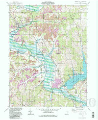
1994 Map of Mineral City
USGS Topo · Published 1998About this map
The United States Railroad cuts a path through the rolling coal country of eastern Ohio, where the legacy of extraction is visible in numerous Strip Mines and Gas Wells scattered across the landscape. This region, shared between Tuscarawas and Carroll Counties, centers on the village of Mineral City, with smaller settlements like Somerdale and New Cumberland following the creek valleys.
Find a feature on this map
44 named features on this map. Tap any name to fly to it.
Don’t see what you’re looking for? This feature index may not catch every label — zoom into the map to look around manually.
Map Details
Editions of this 1994 Mineral City Map
This is the sole edition of this map. No revisions or reprints were ever made.
Other maps of this area

1902 · Scio
USGS Topo · 1:62,500

1904 · Scio
USGS Topo · 1:62,500

1909 · Uhrichsville
USGS Topo · 1:62,500

1910 · Carrollton
USGS Topo · 1:62,500

1911 · Uhrichsville
USGS Topo · 1:62,500

1912 · Dover
USGS Topo · 1:62,500

1912 · Carrollton
USGS Topo · 1:62,500

1944 · Dover
USGS Topo · 1:62,500

1951 · Canton
USGS Topo · 1:250,000

1951 · Bolivar
USGS Topo · 1:24,000