
1937 Map of Mineral Hill
USGS Topo · Published 1937About this map
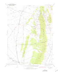
The Eureka Nevada RR follows the western base of the Sulphur Spring Range, connecting high-desert mining and ranching hubs during the late 1930s. This survey, conducted by R. R. Monbeck, captures a landscape defined by its vital water sources, from Sulphur Spr in the north to Chimney Sprs at the southern edge. The map documents the localized mining activity at the Mineral Hill settlement and the Old Whalen Mine, while showing the established livestock economy through family holdings like the Bruffey Ranch, Flynn Ranch, and Alpha Ranch. The terrain transitions sharply from the alluvial flats of the railroad corridor into the complex drainages of Slaughterhouse Canyon and Grass Valley Canyon, illustrating the importance of natural springs for survival in this arid territory.
Find a feature on this map
67 named features on this map. Tap any name to fly to it.
Don’t see what you’re looking for? This feature index may not catch every label — zoom into the map to look around manually.
Map Details
Editions of this 1937 Mineral Hill Map
4 editions found
Other maps of this area

1926 · Roberts Mountains
USGS Topo · 1:250,000

1929 · Roberts Mountains
USGS Topo · 1:250,000

1934 · Jiggs
USGS Topo · 1:125,000

1937 · Jiggs
USGS Topo · 1:125,000

1943 · Mineral Hill
USGS Topo · 1:62,500

1949 · Garden Valley
USGS Topo · 1:62,500

1949 · Roberts Creek Mtn
USGS Topo · 1:62,500

1951 · Roberts Creek Mtn
USGS Topo · 1:62,500

1951 · Garden Valley
USGS Topo · 1:62,500

1952 · Pine Valley
USGS Topo · 1:62,500