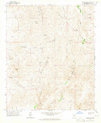
1964 Map of Mineral Mtn
USGS Topo · Published 1965About this map
Mining operations and rugged desert topography define this corner of Pinal County in the early 1960s. The settlement of Reymert is shown as a site, anchoring a landscape heavily marked by mineral extraction. Numerous claims and shafts are scattered throughout the region, including the Reymert Mine, Woodpecker Mine, and the curiously named Orphan Boy Mine. These sites are linked by a network of jeep trails that navigate the complex drainages of Box Canyon and Martinez Canyon.
Find a feature on this map
29 named features on this map. Tap any name to fly to it.
Don’t see what you’re looking for? This feature index may not catch every label — zoom into the map to look around manually.
Map Details
Editions of this 1964 Mineral Mtn Map
3 editions found
Other maps of this area

1900 · Florence
USGS Topo · 1:125,000

1902 · Florence
USGS Topo · 1:125,000

1948 · Superior
USGS Topo · 1:62,500

1948 · Superior
USGS Topo · 1:24,000

1948 · Picketpost Mtn
USGS Topo · 1:24,000

1949 · Superior
USGS Topo · 1:24,000

1949 · Picketpost Mtn
USGS Topo · 1:24,000

1954 · Mesa
USGS Topo · 1:250,000

1957 · Mesa
USGS Topo · 1:250,000

1958 · Mesa
USGS Topo · 1:250,000