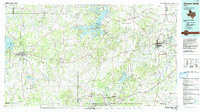
1985 Map of Mineral Wells
USGS Topo · Published 1992About this map
Possum Kingdom Lake dominates the central landscape of this mid-1980s Texas survey, where the winding Brazos River carves through the Palo Pinto Mountains. The mapping captures a region shaped by both its geology and its industrial history, specifically around Thurber and Strawn, areas historically significant for their coal production as evidenced by the presence of a Coal Mine and gravel operations. To the east, the footprint of the Wolters Military Reservation sits adjacent to Mineral Wells, a city whose development was long tied to the mineral water trade and military presence. This sheet also details the western expansion of North Central Texas water management with Hubbard Creek Lake near Breckenridge. The complex terrain is marked by numerous peaks like McAdams Peak and named gaps like Metcalf Gap, providing a clear look at the transit corridors between the Brazos valley and the western plains.
Find a feature on this map
105 named features on this map. Tap any name to fly to it.
Don’t see what you’re looking for? This feature index may not catch every label — zoom into the map to look around manually.
Map Details
Editions of this 1985 Mineral Wells Map
2 editions found
Other maps of this area

1889 · Granbury
USGS Topo · 1:125,000

1890 · Stephenville
USGS Topo · 1:125,000

1890 · Breckenridge
USGS Topo · 1:125,000

1891 · Weatherford
USGS Topo · 1:125,000

1891 · Palo Pinto
USGS Topo · 1:125,000

1892 · Albany
USGS Topo · 1:125,000

1893 · Albany
USGS Topo · 1:125,000

1893 · Weatherford
USGS Topo · 1:125,000

1894 · Eastland
USGS Topo · 1:125,000

1918 · Palo Pinto
USGS Topo · 1:125,000