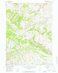
1954 Map of Miners Delight
USGS Topo · Published 1961About this map
Miners Delight serves as the focal point of this mid-century survey of the Wyoming gold fields within the Shoshone National Forest. The landscape is a network of mining claims and rugged terrain, featuring the Miners Delight Mine, Gold Dollar Mine, and Caribou Mine. This era of the 1950s shows the region's transition from active extraction to a historical landscape, specifically preserved at Fort Stambaugh (Historical Site).
Find a feature on this map
45 named features on this map. Tap any name to fly to it.
Don’t see what you’re looking for? This feature index may not catch every label — zoom into the map to look around manually.
Map Details
Editions of this 1954 Miners Delight Map
4 editions found
Other maps of this area

1953 · Gravel Spring
USGS Topo · 1:24,000

1953 · Radium Springs
USGS Topo · 1:24,000

1953 · Atlantic City
USGS Topo · 1:24,000

1953 · Fossil Hill
USGS Topo · 1:24,000

1953 · Louis Lake
USGS Topo · 1:24,000

1953 · South Pass City
USGS Topo · 1:24,000

1953 · Weiser Pass
USGS Topo · 1:24,000

1954 · Wolf Point
USGS Topo · 1:24,000

1954 · Miners Delight
USGS Topo · 1:24,000

1955 · Lander
USGS Topo · 1:250,000