
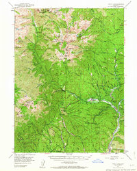
1950 Map of Minersville
USGS Topo · Published 1952About this map
Minersville and Old Minersville anchor this 1950s survey of the Trinity Alps region, showing the landscape before the creation of Trinity Lake. The map documents a transition from early mining and ranching to a mid-century period of forestry and recreation. Historic resource extraction is evidenced by the Perry Mine, Saxe Mine, and the hydraulic engineering of the Coffee Ditch. Traditional land use is visible at Bricks Ranch and Cedar Stock Farm, while the settlement at Covington Mill and the Ridgeville Cemetery provide critical points of reference for genealogists and local historians.
Find a feature on this map
138 named features on this map. Tap any name to fly to it.
Don’t see what you’re looking for? This feature index may not catch every label — zoom into the map to look around manually.
Map Details
Editions of this 1950 Minersville Map
4 editions found
Other maps of this area

1886 · Shasta
USGS Topo · 1:250,000

1890 · Red Bluff
USGS Topo · 1:250,000

1894 · Red Bluff
USGS Topo · 1:250,000

1894 · Shasta
USGS Topo · 1:250,000

1909 · Big Bar
USGS Topo · 1:96,000

1913 · Weaverville
USGS Topo · 1:125,000

1915 · Big Bar and Vicinity
USGS Topo · 1:250,000

1923 · Sawyers Bar
USGS Topo · 1:125,000

1931 · Etna
USGS Topo · 1:96,000

1934 · Etna
USGS Topo · 1:125,000