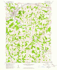
1960 Map of Minerva
USGS Topo · Published 1961About this map
Minerva serves as the primary hub of this 1960 landscape, situated at the busy intersection of the Pennsylvania, N Y Chicago and St Louis, and New York Central railroads. The town's industrial character is reinforced by surrounding Sand and Gravel Pits and a complex rail network that follows the path of Sandy Creek. South of the village, the terrain transitions into a mosaic of small rural communities and family landmarks, where the Geographers Line marks a significant historical surveying boundary between Brown and Augusta townships.
Find a feature on this map
71 named features on this map. Tap any name to fly to it.
Don’t see what you’re looking for? This feature index may not catch every label — zoom into the map to look around manually.
Map Details
Editions of this 1960 Minerva Map
2 editions found
Other maps of this area

1905 · Salineville
USGS Topo · 1:62,500

1909 · Alliance
USGS Topo · 1:62,500

1909 · Lisbon
USGS Topo · 1:62,500

1910 · Carrollton
USGS Topo · 1:62,500

1912 · Carrollton
USGS Topo · 1:62,500

1951 · Canton
USGS Topo · 1:250,000

1953 · Canton
USGS Topo · 1:250,000

1957 · Canton
USGS Topo · 1:250,000
1959 · Dellroy
USGS Topo · 1:24,000
1959 · Hanoverton
USGS Topo · 1:24,000