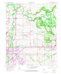
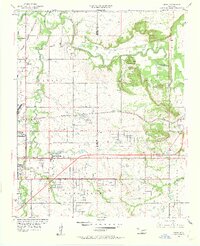
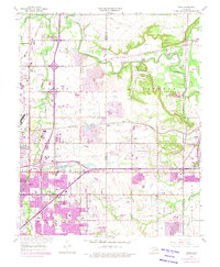
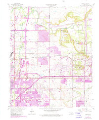
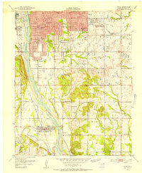
1955 Map of Mingo
USGS Topo · Published 1968About this map
Bird Creek and Mingo Creek define the drainage of this northeastern Oklahoma landscape, where the expanding urban footprint of Tulsa meets established rural communities. This document, revised in the late 1960s, records a transitional period of infrastructure development, most notably the path of the Will Rogers Toll Road Turnpike and the Tulsa International Airport. While industrial activity is evident through numerous quarries and oil wells, the map also captures localized social centers like Plainview Ch and Dick Cem. Significant educational expansion is visible through many named institutions such as East Central High Sch and Foster Jr High Sch. The intersection of heavy rail like the St Louis San Francisco and local roads like Admiral Place illustrates the area's role as a major regional transport hub during the mid-20th century.
Find a feature on this map
51 named features on this map. Tap any name to fly to it.
Don’t see what you’re looking for? This feature index may not catch every label — zoom into the map to look around manually.
Map Details
Editions of this 1955 Mingo Map
5 editions found
Other maps of this area

1901 · Claremore
USGS Topo · 1:125,000

1914 · Claremore
USGS Topo · 1:125,000

1916 · Claremore
USGS Topo · 1:125,000
1952 · Jenks
USGS Topo · 1:24,000

1954 · Tulsa
USGS Topo · 1:250,000

1954 · Tulsa
USGS Topo · 1:24,000
1955 · Sperry
USGS Topo · 1:24,000

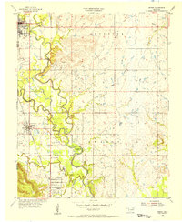
1955 · Mingo
USGS Topo · 1:24,000

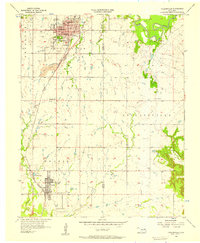
1955 · Broken Arrow
USGS Topo · 1:24,000
1956 · Collinsville
USGS Topo · 1:24,000