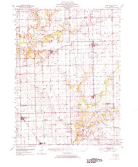
1951 Map of Minier
USGS Topo · Published 1966About this map
The Mackinaw River and its meandering tributaries, including the Little Mackinaw River and Sugar Creek, define the central Illinois landscape of the mid-twentieth century. This mid-century survey illustrates a mature agricultural region organized around the Gulf Mobile and Ohio, Illinois Central, and Pennsylvania railroads. These rail lines supported established grain-handling hubs like Minier, Hopedale, and Armington.
Find a feature on this map
68 named features on this map. Tap any name to fly to it.
Don’t see what you’re looking for? This feature index may not catch every label — zoom into the map to look around manually.
Map Details
Editions of this 1951 Minier Map
3 editions found

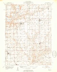
Other maps of this area

1905 · Peoria
USGS Topo · 1:62,500

1911 · Lincoln
USGS Topo · 1:62,500

1913 · Lincoln
USGS Topo · 1:62,500

1927 · Peoria
USGS Topo · 1:62,500

1927 · Danvers
USGS Topo · 1:62,500

1928 · Mackinaw
USGS Topo · 1:62,500

1930 · Danvers
USGS Topo · 1:62,500

1932 · Mackinaw
USGS Topo · 1:62,500

1942 · Delavan
USGS Topo · 1:62,500

1948 · Mason City
USGS Topo · 1:62,500