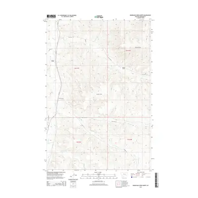
2014 Map of Minnehaha Creek North
USGS Topo · Published 2014About this map
Minnehaha Creek and its surrounding drainage basin define the terrain of this Treasure County landscape. The map reveals a complex network of waterways including Sarpy Creek and Beaver Creek, alongside more distinctively named topographical features like Outlaw Coulee and Sawmill Coulee. These names suggest a history of early ranching and resource extraction, where the naming of Outlaw Spring and Sawmill Coulee points to the functional and social priorities of earlier inhabitants in this arid environment.
Find a feature on this map
22 named features on this map. Tap any name to fly to it.
Don’t see what you’re looking for? This feature index may not catch every label — zoom into the map to look around manually.
Map Details
Editions of this 2014 Minnehaha Creek North Map
This is the sole edition of this map. No revisions or reprints were ever made.
Other maps of this area

1954 · Hardin
USGS Topo · 1:250,000

1954 · Forsyth
USGS Topo · 1:250,000

1957 · Hardin
USGS Topo · 1:250,000

1957 · Forsyth
USGS Topo · 1:250,000

1958 · Forsyth
USGS Topo · 1:250,000

1958 · Hardin
USGS Topo · 1:250,000

1971 · Mc Clure Creek
USGS Topo · 1:24,000

1971 · Griffin Coulee SW
USGS Topo · 1:24,000
1971 · Griffin Coulee NW
USGS Topo · 1:24,000

1972 · Minnehaha Creek South
USGS Topo · 1:24,000