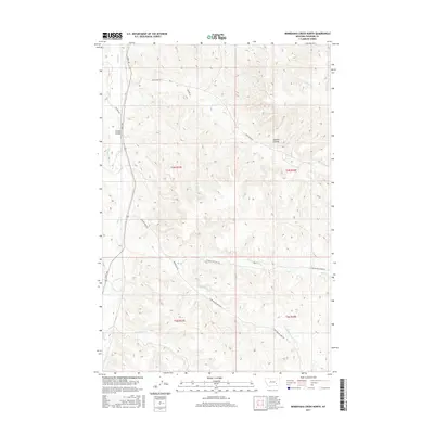
2017 Map of Minnehaha Creek North
USGS Topo · Published 2017About this map
Outlaw Spring and the surrounding drainages of Sarpy Cr define this section of Treasure County, Montana. The landscape is marked by a network of seasonal watercourses and coulees, including Sawmill Coulee and Outlaw Coulee, which serve as natural landmarks for the regional ranching and grazing operations. The map details the transition from the Bear Cr watershed in the north to the Minnehaha Cr and Beaver Cr systems further south. Roads such as Sarpy Rd and Bear Creek Rd provide the primary access through these townships, following the natural contours of the terrain. This survey provides a precise look at the rural section lines and public land survey system boundaries including t4n r37e and t3n r38e, essential for understanding local property history and land use in this part of Big Sky Country.
Find a feature on this map
21 named features on this map. Tap any name to fly to it.
Don’t see what you’re looking for? This feature index may not catch every label — zoom into the map to look around manually.
Map Details
Editions of this 2017 Minnehaha Creek North Map
This is the sole edition of this map. No revisions or reprints were ever made.
Other maps of this area

1954 · Hardin
USGS Topo · 1:250,000

1954 · Forsyth
USGS Topo · 1:250,000

1957 · Hardin
USGS Topo · 1:250,000

1957 · Forsyth
USGS Topo · 1:250,000

1958 · Forsyth
USGS Topo · 1:250,000

1958 · Hardin
USGS Topo · 1:250,000

1971 · Mc Clure Creek
USGS Topo · 1:24,000

1971 · Griffin Coulee SW
USGS Topo · 1:24,000
1971 · Griffin Coulee NW
USGS Topo · 1:24,000

1972 · Minnehaha Creek South
USGS Topo · 1:24,000