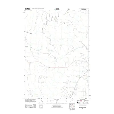
2012 Map of Minnekahta NE
USGS Topo · Published 2012About this map
Erskine sits at a central point within this landscape of the southern Black Hills region, where a network of forest and county roads connects the dispersed local geography. The drainage patterns of Cottonwood Springs Cr and Hot Brook carve through the terrain, with Booms Canyon providing a distinctive topographic landmark to the northwest. This 2012 survey illustrates a transition in land use, showing the intersection of recreational and residential developments such as Country Club Dr alongside more utilitarian forest routes like Fs Rd 682 and Argyle Rd. Local nomenclature is preserved through family-named paths like Robertson Br 1J and Robertson Br 1A, indicating long-standing land holdings and rural access routes that define the character of this part of Fall River County.
Find a feature on this map
17 named features on this map. Tap any name to fly to it.
Don’t see what you’re looking for? This feature index may not catch every label — zoom into the map to look around manually.
Map Details
Editions of this 2012 Minnekahta NE Map
This is the sole edition of this map. No revisions or reprints were ever made.
Other maps of this area

1894 · Hermosa
USGS Topo · 1:125,000

1896 · Oelrichs
USGS Topo · 1:125,000

1896 · Harney Peak
USGS Topo · 1:125,000

1900 · Oelrichs
USGS Topo · 1:125,000

1901 · Hermosa
USGS Topo · 1:125,000

1901 · Harney Peak
USGS Topo · 1:125,000

1902 · Edgemont
USGS Topo · 1:125,000

1950 · Hot Springs
USGS Topo · 1:24,000

1950 · Cascade Springs
USGS Topo · 1:24,000

1950 · Angostura Reservoir
USGS Topo · 1:24,000