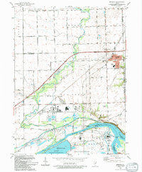
1993 Map of Minooka
USGS Topo · Published 1994About this map
The confluence of the Illinois River, Kankakee River, and Des Plaines River creates a complex industrial and ecological landscape at the southern edge of Minooka. This late-twentieth-century study details the heavy infrastructure of the era, including the Dresden Station Nuclear Powerplant and the Dresden Island Lock and Dam. While the northern portion of the map retains its rural character with long roads like White Willow Road and Bell Road, the river corridor is a hub of transport and energy. The historic Illinois and Michigan Canal State Trail runs parallel to the modern river works, passing the Aux Sable Lock. Genealogists will find several landmarks of interest, from the Plattville Ch in the northwest to St Marys Cem near the town center, and the remote Chapman Cem on the county line.
Find a feature on this map
50 named features on this map. Tap any name to fly to it.
Don’t see what you’re looking for? This feature index may not catch every label — zoom into the map to look around manually.
Map Details
Editions of this 1993 Minooka Map
This is the sole edition of this map. No revisions or reprints were ever made.
Other maps of this area

1892 · Morris
USGS Topo · 1:62,500

1892 · Joliet
USGS Topo · 1:62,500

1892 · Wilmington
USGS Topo · 1:62,500

1918 · Wilmington
USGS Topo · 1:62,500

1918 · Morris
USGS Topo · 1:62,500

1923 · Joliet
USGS Topo · 1:62,500

1925 · Yorkville
USGS Topo · 1:62,500

1953 · Morris
USGS Topo · 1:24,000

1953 · Plattville
USGS Topo · 1:24,000

1953 · Lisbon
USGS Topo · 1:24,000