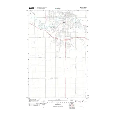
2011 Map of Minot
USGS Topo · Published 2011About this map
The Souris River carves a winding path through Minot, defining the city’s early 21st-century footprint and its relationship with the water. This 2011 survey illustrates a mature urban landscape where civic and academic life is anchored by Minot State University in the north. The map documents significant local infrastructure including the Minot Water Supply Dam and the expansive grounds of the Souris Valley Golf Course along the river's bends. For researchers interested in the community's heritage, the presence of both the Hebrew Cemetery and Rosehill Cemetery offer key points for genealogical study. Outside the dense city grid, the land transitions into a systematic network of section roads like 93rd Ave SW and 54th Ave SE, showing the continued influence of the Public Land Survey System on North Dakota's modern development.
Find a feature on this map
36 named features on this map. Tap any name to fly to it.
Don’t see what you’re looking for? This feature index may not catch every label — zoom into the map to look around manually.
Map Details
Editions of this 2011 Minot Map
This is the sole edition of this map. No revisions or reprints were ever made.
Other maps of this area

1928 · Minot
USGS Topo · 1:62,500

1929 · Sawyer
USGS Topo · 1:62,500

1948 · Burlington
USGS Topo · 1:24,000

1948 · Burlington
USGS Topo · 1:62,500

1948 · Minot NW
USGS Topo · 1:24,000

1948 · Surrey
USGS Topo · 1:24,000

1949 · Minot NW
USGS Topo · 1:24,000

1949 · Deering SW
USGS Topo · 1:24,000

1949 · Burlington SE
USGS Topo · 1:24,000

1949 · Surrey
USGS Topo · 1:24,000