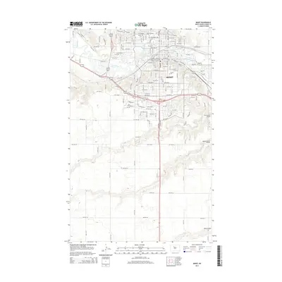
2014 Map of Minot
USGS Topo · Published 2014About this map
The city of Minot is centered on this 2014 survey, where the Souris River bends through the valley floor. The map documents the extensive urban grid and educational footprint of Minot State University, situated just north of the river. Evidence of the city's growth is visible in the transition from the densely developed downtown streets to the newer commercial developments at Square Mall. Along the southern and eastern periphery, the landscape shifts into a series of deep drainages including First Larson Coulee, Second Larson Coulee, and Kemp Coulee. Transportation infrastructure is a defining element, from the Soo Line railroad tracks that historically shaped the town to the modern arterials like Central Avenue West and West University Avenue. Cultural history is noted at Rosehill Cemetery and Hebrew Cemetery, providing valuable data points for local genealogists and historians.
Find a feature on this map
131 named features on this map. Tap any name to fly to it.
Don’t see what you’re looking for? This feature index may not catch every label — zoom into the map to look around manually.
Map Details
Editions of this 2014 Minot Map
This is the sole edition of this map. No revisions or reprints were ever made.
Other maps of this area

1928 · Minot
USGS Topo · 1:62,500

1929 · Sawyer
USGS Topo · 1:62,500

1948 · Burlington
USGS Topo · 1:24,000

1948 · Burlington
USGS Topo · 1:62,500

1948 · Minot NW
USGS Topo · 1:24,000

1948 · Surrey
USGS Topo · 1:24,000

1949 · Minot NW
USGS Topo · 1:24,000

1949 · Deering SW
USGS Topo · 1:24,000

1949 · Burlington SE
USGS Topo · 1:24,000

1949 · Surrey
USGS Topo · 1:24,000