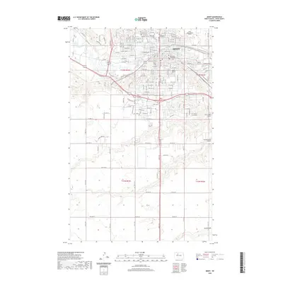
2020 Map of Minot
USGS Topo · Published 2020About this map
Minot serves as the focal point of this 2020 landscape, where the Souris River meanders through a structured grid of residential and commercial development. The city's civic and educational heart is clearly defined, featuring the Ward County Courthouse and the expansive campus of Minot State University. To the north, the Minot International Airport dominates the plateau, while the southern reaches of the map transition into the undulating coulee country of the northern plains. This area is dissected by drainage features such as First Larson Coulee, Second Larson Coulee, and Kemp Coulee, which provide topographical contrast to the plateau. For those researching local heritage, several significant burial sites are meticulously mapped, including the Rosehill Memorial Park, Hebrew Cem, and the First Lutheran Church Cem, anchoring the modern city to its community roots.
Find a feature on this map
140 named features on this map. Tap any name to fly to it.
Don’t see what you’re looking for? This feature index may not catch every label — zoom into the map to look around manually.
Map Details
Editions of this 2020 Minot Map
This is the sole edition of this map. No revisions or reprints were ever made.
Other maps of this area

1928 · Minot
USGS Topo · 1:62,500

1929 · Sawyer
USGS Topo · 1:62,500

1948 · Burlington
USGS Topo · 1:24,000

1948 · Burlington
USGS Topo · 1:62,500

1948 · Minot NW
USGS Topo · 1:24,000

1948 · Surrey
USGS Topo · 1:24,000

1949 · Minot NW
USGS Topo · 1:24,000

1949 · Deering SW
USGS Topo · 1:24,000

1949 · Burlington SE
USGS Topo · 1:24,000

1949 · Surrey
USGS Topo · 1:24,000