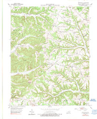
1953 Map of Mintonville
USGS Topo · Published 1989About this map
Mintonville and Bethelridge anchor this topographic study of the central Kentucky uplands along the Casey and Pulaski County line. The landscape is defined by a dense network of ridgelines, including Chestnut Level Ridge and Vaught Ridge, which separated the rural communities of the early 1950s. The settlement pattern here is distinctly decentralized, with local life organized around country schools like Chuckaluck Sch and Fairview Sch, and small spiritual centers such as Bradley Pleasure Ch and Watson Chapel.
Find a feature on this map
61 named features on this map. Tap any name to fly to it.
Don’t see what you’re looking for? This feature index may not catch every label — zoom into the map to look around manually.
Map Details
Editions of this 1953 Mintonville Map
3 editions found
Other maps of this area

1935 · Somerset
USGS Topo · 1:62,500

1952 · Eubank
USGS Topo · 1:24,000

1952 · Liberty
USGS Topo · 1:24,000

1952 · Yosemite
USGS Topo · 1:24,000

1953 · Phil
USGS Topo · 1:24,000

1953 · Mintonville
USGS Topo · 1:24,000

1954 · Delmer
USGS Topo · 1:24,000

1954 · Science Hill
USGS Topo · 1:24,000

1954 · Eli
USGS Topo · 1:24,000
1954 · Faubush
USGS Topo · 1:24,000