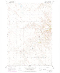
1956 Map of Miscol SE
USGS Topo · Published 1978About this map
Little Oak defines the upland terrain of this portion of the Standing Rock Indian Reservation in the mid-1950s. The landscape is characterized by a high plateau dissected by the drainage of High Bank Creek, reflecting the rural character of northern South Dakota during the mid-twentieth century. Educational infrastructure of the era is represented by the remote placements of Chapel Sch and Long Butte Sch, which served the scattered residents of this high-plains environment. The map shows the transition of the region under the Department of the Interior's Missouri River Basin development program, illustrating the topographic detail and early road network before later 1970s revisions were noted.
Find a feature on this map
4 named features on this map. Tap any name to fly to it.
Don’t see what you’re looking for? This feature index may not catch every label — zoom into the map to look around manually.
Map Details
Editions of this 1956 Miscol SE Map
2 editions found
Other maps of this area

1953 · McIntosh
USGS Topo · 1:250,000

1956 · Miscol SW
USGS Topo · 1:24,000

1956 · Little Eagle SW
USGS Topo · 1:24,000

1956 · Miscol SE
USGS Topo · 1:24,000

1956 · Little Eagle NW
USGS Topo · 1:24,000

1956 · Miscol
USGS Topo · 1:24,000

1956 · Miscol NE
USGS Topo · 1:24,000

1958 · McIntosh
USGS Topo · 1:250,000

1975 · Glencross
USGS Topo · 1:24,000

1978 · Brewer Butte
USGS Topo · 1:24,000