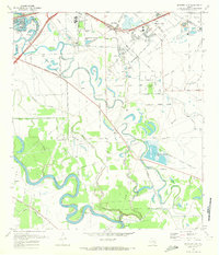
1970 Map of Missouri City
USGS Topo · Published 1973About this map
The Brazos River and Oyster Creek define the landscape of Fort Bend County in the late 1960s, showing a region transitioning from traditional agriculture to suburban expansion. The intricate meanders of Oyster Creek are flanked by numerous oxbow lakes such as Frost Lake and Hermann Hospital Lake, while the corporate boundaries of Missouri City and Sugar Land begin to push toward one another. Local history is anchored by early settlements and family landmarks, including Trammels, Dewalt, and the small community at Herbert.
Find a feature on this map
52 named features on this map. Tap any name to fly to it.
Don’t see what you’re looking for? This feature index may not catch every label — zoom into the map to look around manually.
Map Details
Editions of this 1970 Missouri City Map
3 editions found
Other maps of this area

1915 · Bellaire
USGS Topo · 1:24,000

1915 · Alief
USGS Topo · 1:24,000

1915 · Clodine
USGS Topo · 1:24,000

1919 · Clodine
USGS Topo · 1:31,680

1920 · Almeda
USGS Topo · 1:31,680

1921 · Bellaire
USGS Topo · 1:31,680

1943 · Juliff
USGS Topo · 1:31,680

1950 · Houston
USGS Topo · 1:250,000

1953 · Lake George
USGS Topo · 1:24,000

1953 · Thompsons
USGS Topo · 1:24,000