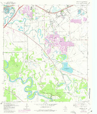
1970 Map of Missouri City
USGS Topo · Published 1980About this map
The Brazos River meanders through the southern portion of this landscape, its tight oxbows defining the geography of the era. The 1970s marked a significant period of expansion for Missouri City and Stafford, as suburban development began to press into the agricultural lands of Fort Bend Co. This growth is visible in the purple revisions that trace new streets and residential tracts near the Willowisp Country Club. Away from the urbanizing centers, the map preserves older rural patterns, including the small settlement of Dewalt and several historic burial grounds like Cementerio San Isidro and New Hope Cem. The region's hydraulic history is on display through the complex network of the American Canal, Oyster Creek, and Snake Slough, which supported the local economy alongside the Southern Pacific and Missouri Pacific railroads.
Find a feature on this map
59 named features on this map. Tap any name to fly to it.
Don’t see what you’re looking for? This feature index may not catch every label — zoom into the map to look around manually.
Map Details
Editions of this 1970 Missouri City Map
3 editions found
Other maps of this area

1915 · Bellaire
USGS Topo · 1:24,000

1915 · Alief
USGS Topo · 1:24,000

1915 · Clodine
USGS Topo · 1:24,000

1919 · Clodine
USGS Topo · 1:31,680

1920 · Almeda
USGS Topo · 1:31,680

1921 · Bellaire
USGS Topo · 1:31,680

1943 · Juliff
USGS Topo · 1:31,680

1950 · Houston
USGS Topo · 1:250,000

1953 · Lake George
USGS Topo · 1:24,000

1953 · Thompsons
USGS Topo · 1:24,000