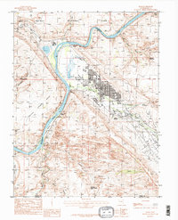
1985 Map of Moab
USGS Topo · Published 1986About this map
Moab occupies a central position in the Moab Valley during the mid-1980s, serving as a gateway to the spectacular geological formations of Arches National Park to the north. The Colorado River carves a deep path through the landscape, flanked by dramatic features like Poison Spider Mesa and Kings Bottom. The map reveals the critical importance of water in this arid environment, evidenced by Jackson Reservoir and various perennial flows such as Mill Creek and Pack Creek that support the town and surrounding Spanish Valley.
Find a feature on this map
33 named features on this map. Tap any name to fly to it.
Don’t see what you’re looking for? This feature index may not catch every label — zoom into the map to look around manually.
Map Details
Editions of this 1985 Moab Map
3 editions found
Other maps of this area

1885 · La Sal
USGS Topo · 1:250,000

1952 · Moab 4 NW
USGS Topo · 1:24,000

1952 · Moab 4 SW
USGS Topo · 1:24,000

1954 · Mt Peale 2 NW
USGS Topo · 1:24,000

1954 · Carlisle 1 NE
USGS Topo · 1:24,000

1954 · Carlisle 1 NW
USGS Topo · 1:24,000

1954 · Mt. Waas 3 NW
USGS Topo · 1:24,000

1954 · Mt. Waas 3 SW
USGS Topo · 1:24,000

1954 · La Sal Junction
USGS Topo · 1:62,500

1954 · Castle Valley
USGS Topo · 1:62,500