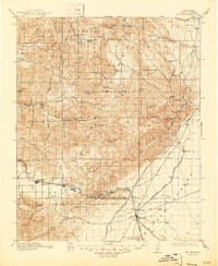
1915 Map of Mojave
USGS Topo · Published 1947About this map
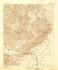
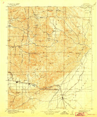
The Mojave Desert and the eastern heights of the Tehachapi Mountains meet in this 1915 survey, documenting a landscape defined by the arrival of the Los Angeles Aqueduct and the intersection of vital transit routes. The growing rail hub of Mojave sits at the junction of the Southern Pacific and the A T and S F, while the Owenyo Branch strikes north toward Neuralia. In the higher elevations, the Piute Mountains are dotted with early mining operations like the Burning Moscow Mine and Gwynne Mine, alongside high-altitude meadows such as Landers Meadow. This era represents a significant transition for Kern County, as the cement works at Monolith and the railroad summit at Tehachapi supported the massive infrastructure projects of the early twentieth century. Nearby, smaller stops like Loraine P O and Old Town provide evidence of earlier settlement patterns before the dominance of the larger rail towns.
Find a feature on this map
81 named features on this map. Tap any name to fly to it.
Don’t see what you’re looking for? This feature index may not catch every label — zoom into the map to look around manually.
Map Details
Editions of this 1915 Mojave Map
7 editions found
Other maps of this area

1903 · Tejon
USGS Topo · 1:125,000

1906 · Kernville
USGS Topo · 1:125,000

1908 · Kernville
USGS Topo · 1:125,000

1914 · Caliente
USGS Topo · 1:125,000

1915 · Elizabeth Lake
USGS Topo · 1:125,000

1915 · Searles Lake
USGS Topo · 1:250,000

1915 · Mojave
USGS Topo · 1:125,000

1917 · Elizabeth Lake
USGS Topo · 1:125,000

1920 · Delonagha
USGS Topo · 1:62,500

1926 · Glennville
USGS Topo · 1:62,500