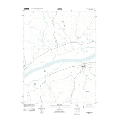
2012 Map of Mokane East
USGS Topo · Published 2012About this map
The Missouri River bisects this riverine landscape, creating a complex network of chutes and islands between the towns of Chamois and Mokane. Near the southern bank, the town of Chamois serves as a hub for local routes like Huffs Way and Rose St, while the northern bank features the smaller settlements of Steedman and Mokane. The map documents significant local genealogy landmarks, including the Bode Cemetery, Stoner Cemetery, and Hughes Cemetery scattered across the undulating terrain. The hydrology of the area is particularly detailed, showing the Mollie Dozier Chute and Saint Aubert Chute as they carve paths around Binggeli Island and Saint Aubert Island. Numerous drainages such as Auxvasse Creek and Dooling Creek feed into the river, illustrating the natural irrigation patterns that have long influenced the development of these Missouri communities.
Find a feature on this map
58 named features on this map. Tap any name to fly to it.
Don’t see what you’re looking for? This feature index may not catch every label — zoom into the map to look around manually.
Map Details
Editions of this 2012 Mokane East Map
This is the sole edition of this map. No revisions or reprints were ever made.
Other maps of this area

1890 · Fulton
USGS Topo · 1:125,000

1928 · Fulton
USGS Topo · 1:62,500

1931 · Fulton
USGS Topo · 1:62,500

1935 · Morrison
USGS Topo · 1:48,000

1940 · Montgomery City
USGS Topo · 1:62,500

1942 · Montgomery City
USGS Topo · 1:62,500

1942 · Morrison
USGS Topo · 1:62,500

1945 · Mokane
USGS Topo · 1:62,500

1945 · Morrison
USGS Topo · 1:62,500

1949 · Saint Louis
USGS Topo · 1:250,000