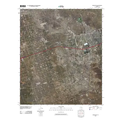
2010 Map of Monahans
USGS Topo · Published 2010About this map
Monahans serves as a regional hub in this West Texas landscape, where the traditional ranching economy meets the industrial footprint of the Permian Basin. The town's grid expands toward Thorntonville to the west, situated near the Roy Hurd Memorial Airport. The map documents a complex network of ranch roads and local streets, such as State Spur 57 and Ranch Rd 1219, which provide access to both the energy sector and agricultural operations. Evidence of the area's resource-driven economy is clear through the presence of the Ward Estes North Oil Field and various family-named landmarks like Wagonwheel Ranch. Water remains a critical resource for the high plains, noted by several outlying features including the North Windmill and the Blueberry Windmill.
Find a feature on this map
25 named features on this map. Tap any name to fly to it.
Don’t see what you’re looking for? This feature index may not catch every label — zoom into the map to look around manually.
Map Details
Editions of this 2010 Monahans Map
This is the sole edition of this map. No revisions or reprints were ever made.
Other maps of this area

1931 · Barstow
USGS Topo · 1:125,000

1954 · Pecos
USGS Topo · 1:250,000

1957 · Pecos
USGS Topo · 1:250,000

1963 · China Lake NE
USGS Topo · 1:24,000

1968 · Monahans SE
USGS Topo · 1:24,000

1968 · Cowden Place
USGS Topo · 1:24,000

1968 · China Ranch
USGS Topo · 1:24,000

1969 · Ozark Lake
USGS Topo · 1:24,000

1969 · Pyote NE
USGS Topo · 1:24,000

1969 · Pyote East
USGS Topo · 1:24,000