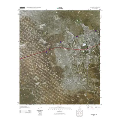
2012 Map of Monahans
USGS Topo · Published 2012About this map
The West Texas town of Monahans serves as the focal point of this 2012 survey, revealing the structured street grid and industrial footprint of Ward County. The landscape is defined by the intersection of major thoroughfares like Ranch Road 1219 and State Spur 57, which support the regional energy and ranching economies. To the west, the Ward Estes North Oil Field and the Wagonwheel Ranch occupy broad sections of the arid terrain, illustrating the dual reliance on mineral extraction and livestock. Local infrastructure is highlighted by the Roy Hurd Memorial Airport and the neighboring community of Thorntonville. Scattered throughout the survey are traditional markers of the Permian Basin's working landscape, including the North Windmill and Blueberry Windmill, which signify the vital importance of water management in this high plains environment.
Find a feature on this map
70 named features on this map. Tap any name to fly to it.
Don’t see what you’re looking for? This feature index may not catch every label — zoom into the map to look around manually.
Map Details
Editions of this 2012 Monahans Map
This is the sole edition of this map. No revisions or reprints were ever made.
Other maps of this area

1931 · Barstow
USGS Topo · 1:125,000

1954 · Pecos
USGS Topo · 1:250,000

1957 · Pecos
USGS Topo · 1:250,000

1963 · China Lake NE
USGS Topo · 1:24,000

1968 · Monahans SE
USGS Topo · 1:24,000

1968 · Cowden Place
USGS Topo · 1:24,000

1968 · China Ranch
USGS Topo · 1:24,000

1969 · Ozark Lake
USGS Topo · 1:24,000

1969 · Pyote NE
USGS Topo · 1:24,000

1969 · Pyote East
USGS Topo · 1:24,000