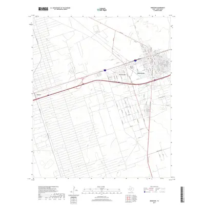
2019 Map of Monahans
USGS Topo · Published 2019About this map
Monahans serves as the regional hub for Ward County, defined by its rectilinear street grid and proximity to the Roy Hurd Memorial Airport. This 2019 survey captures the developed corridor stretching west along Interstate 20 and W Sealy Ave, linking the main settlement to Thorntonville and the edge of Wickett. The landscape beyond the town center is marked by a dense network of ranch roads and service lanes, such as Anthony Ranch Rd and Ranch RD 1233, which suggest the area's ongoing involvement in the West Texas oil and ranching economies. While the urban area is tightly clustered, the surrounding terrain is etched with long, straight property boundaries and access paths that extend deep into the Permian Basin flats, reflecting the systematic division of land characteristic of this part of the state.
Find a feature on this map
102 named features on this map. Tap any name to fly to it.
Don’t see what you’re looking for? This feature index may not catch every label — zoom into the map to look around manually.
Map Details
Editions of this 2019 Monahans Map
This is the sole edition of this map. No revisions or reprints were ever made.
Other maps of this area

1931 · Barstow
USGS Topo · 1:125,000

1954 · Pecos
USGS Topo · 1:250,000

1957 · Pecos
USGS Topo · 1:250,000

1963 · China Lake NE
USGS Topo · 1:24,000

1968 · Monahans SE
USGS Topo · 1:24,000

1968 · Cowden Place
USGS Topo · 1:24,000

1968 · China Ranch
USGS Topo · 1:24,000

1969 · Ozark Lake
USGS Topo · 1:24,000

1969 · Pyote NE
USGS Topo · 1:24,000

1969 · Pyote East
USGS Topo · 1:24,000