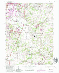
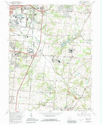
1965 Map of Monroe
USGS Topo · Published 1988About this map
Middletown and Monroe anchor this 1965 survey of the Butler and Warren County line, a landscape defined by the expansion of southwestern Ohio's suburban and industrial corridors. The map records the early footprints of large-scale institutions like the Lebanon Correctional Institution and the Lebanon-Warren County Airport, set against older rural crossroads and family settlements. Genealogists will find a wealth of local landmarks, from the Mound Cemetery and Mt Pleasant Cemetery to vanished-feeling locales like Blue Ball and Beedles Station. This edition, with purple-tinted updates from the 1980s, documents the shift from agrarian townships like Turtle Creek and Lemon toward a more modern landscape. The drainage patterns of Dicks Creek and Shaker Creek provide a natural framework for tracing the area's development before more recent urban sprawl altered these historic property lines and community centers.
Find a feature on this map
72 named features on this map. Tap any name to fly to it.
Don’t see what you’re looking for? This feature index may not catch every label — zoom into the map to look around manually.
Map Details
Editions of this 1965 Monroe Map
5 editions found
Other maps of this area

1904 · Mason
USGS Topo · 1:62,500

1906 · Mason
USGS Topo · 1:62,500

1908 · Miamisburg
USGS Topo · 1:62,500

1913 · Waynesville
USGS Topo · 1:62,500

1914 · Morrow
USGS Topo · 1:62,500

1915 · Waynesville
USGS Topo · 1:62,500

1916 · Morrow
USGS Topo · 1:62,500

1951 · Franklin
USGS Topo · 1:24,000

1953 · Cincinnati
USGS Topo · 1:250,000

1955 · Monroe
USGS Topo · 1:24,000