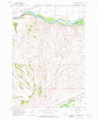
1956 Map of Montaqua
USGS Topo · Published 1977About this map
Montaqua sits at the confluence of several water management systems and early transportation corridors in the mid-1950s. The Yellowstone River and Rock Creek dominate the drainage of this region, which was heavily modified for agricultural use through an extensive network of irrigation features including the Italian Ditch, Old Mill Ditch, and Joliet Ditch. The presence of the Northern Pacific railroad line following the river course indicates the importance of this corridor for regional commerce and transit between Carbon and Stillwater counties. Land use is further characterized by energy infrastructure, such as the Silver Fred Pipeline, and natural curiosities like a Hot Spring near the primary settlement. The topography transitions from the river valley up toward prominent elevations such as Harris Hill and Youngs Point, with drainage defined by numerous seasonal coulees including Peck Gulch and Farewell Creek.
Find a feature on this map
26 named features on this map. Tap any name to fly to it.
Don’t see what you’re looking for? This feature index may not catch every label — zoom into the map to look around manually.
Map Details
Editions of this 1956 Montaqua Map
2 editions found
Other maps of this area

1892 · Stillwater
USGS Topo · 1:125,000

1932 · Red Lodge No 1
USGS Topo · 1:48,000

1954 · Billings
USGS Topo · 1:250,000

1956 · Horse Butte
USGS Topo · 1:24,000

1956 · Silesia
USGS Topo · 1:24,000

1956 · Fromberg
USGS Topo · 1:24,000

1956 · Rapids
USGS Topo · 1:24,000

1956 · Laurel
USGS Topo · 1:24,000
1956 · Boyd
USGS Topo · 1:24,000

1956 · Park City
USGS Topo · 1:24,000