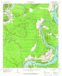
1961 Map of Monterey
USGS Topo · Published 1966About this map
Monterey serves as a focal point for this 1961 survey, situated at the complex junction of the Black River Lake and the winding Cocodrie Bayou. The landscape is a network of backwater channels and bayous, where drainage patterns like Wild Cow Bayou, Greens Bayou, and Whites Bayou illustrate the alluvial character of the Louisiana and Mississippi borderlands. Settlement is concentrated along these watercourses and old transport lines, including the Old Grade Railroad cutting through the western timber. The map documents a distinct phase of river engineering and industrial development, featuring the Glasscock Cutoff on the Mississippi River and numerous active energy sites like the Fairview Oil Field and Quinn Bayou Oil Field. For genealogists, the presence of family-named landmarks and local burial grounds such as Home Place Cem and Rice Cem provides vital clues to the mid-century social geography of Concordia Parish.
Find a feature on this map
61 named features on this map. Tap any name to fly to it.
Don’t see what you’re looking for? This feature index may not catch every label — zoom into the map to look around manually.
Map Details
Editions of this 1961 Monterey Map
3 editions found
Other maps of this area

1909 · Sycamore Landing
USGS Topo · 1:24,000

1909 · Vidalia
USGS Topo · 1:24,000

1921 · Natchez
USGS Topo · 1:48,000

1922 · Natchez
USGS Topo · 1:62,500

1935 · Tooleys
USGS Topo · 1:62,500

1936 · Woodville
USGS Topo · 1:62,500

1939 · Red Gum
USGS Topo · 1:62,500

1939 · Natchez
USGS Topo · 1:62,500

1939 · Kingston
USGS Topo · 1:62,500

1939 · Artonish
USGS Topo · 1:62,500