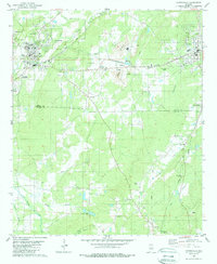
1980 Map of Montevallo
USGS Topo · Published 1987About this map
The University of Montevallo campus serves as a central landmark for this 1980s-era study of central Alabama, situated where the Southern railroad intersects the landscape. The geography is defined by industrial extraction and rural community life, featuring numerous active Quarry sites and Settling Ponds throughout Dry Valley. This industrial presence is balanced by established local institutions like Enon Ch and Clarks Chapel, alongside several family and community burial grounds including the Montevallo Cemetery and Salem Cem.
Find a feature on this map
51 named features on this map. Tap any name to fly to it.
Don’t see what you’re looking for? This feature index may not catch every label — zoom into the map to look around manually.
Map Details
Editions of this 1980 Montevallo Map
3 editions found
Other maps of this area

1890 · Bessemer
USGS Topo · 1:125,000

1891 · Clanton
USGS Topo · 1:125,000

1892 · Bessemer
USGS Topo · 1:125,000

1909 · Columbiana
USGS Topo · 1:62,500

1910 · Montevallo
USGS Topo · 1:62,500

1911 · Columbiana
USGS Topo · 1:62,500

1953 · Montgomery
USGS Topo · 1:250,000

1953 · Birmingham
USGS Topo · 1:250,000

1956 · Birmingham
USGS Topo · 1:250,000

1956 · Montgomery
USGS Topo · 1:250,000