
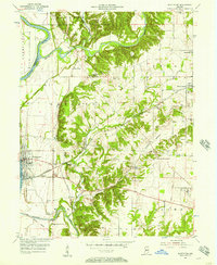
1955 Map of Montezuma
USGS Topo · Published 1957About this map
The Wabash River and Sugar Creek converge in this mid-century portrait of Parke County, where the landscape is defined by the heavy infrastructure of early Indiana commerce. The Abandoned Canal and the Old Indian Treaty Boundary serve as physical reminders of 19th-century expansion, cutting through a terrain now marked by active strip mines, gravel pits, and industrial kilns near Bloomingdale. This survey captures a specific industrial moment, showing the Baltimore and Ohio railroad corridor linking the riverfront at Montezuma to inland agricultural and mining sites.
Find a feature on this map
41 named features on this map. Tap any name to fly to it.
Don’t see what you’re looking for? This feature index may not catch every label — zoom into the map to look around manually.
Map Details
Editions of this 1955 Montezuma Map
2 editions found
Other maps of this area

1948 · Wallace
USGS Topo · 1:24,000

1951 · Clinton
USGS Topo · 1:24,000

1951 · Mecca
USGS Topo · 1:24,000

1952 · Catlin
USGS Topo · 1:24,000

1953 · Indianapolis
USGS Topo · 1:250,000

1955 · Rockville
USGS Topo · 1:24,000

1955 · Kingman
USGS Topo · 1:24,000

1955 · Dana
USGS Topo · 1:24,000
1955 · Newport
USGS Topo · 1:24,000

1956 · Indianapolis
USGS Topo · 1:250,000