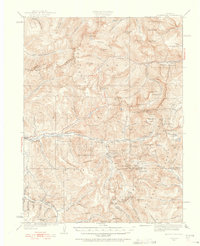
1933 Map of Montezuma
USGS Topo · Published 1956About this map
Montezuma sits at the heart of this high-altitude mining landscape, where the Continental Divide separates the waters of the Snake River from the headwaters of Clear Creek. The area’s industrial character is defined by a dense network of high-elevation prospects and tunnels established during the region's silver and gold mining era. Key operations like the Whale Mine near Swandyke and the Waldorf Mine beneath Mt Edwards reveal the extent of the subsurface engineering required in this terrain.
Find a feature on this map
134 named features on this map. Tap any name to fly to it.
Don’t see what you’re looking for? This feature index may not catch every label — zoom into the map to look around manually.
Map Details
Editions of this 1933 Montezuma Map

Other maps of this area

1889 · Leadville
USGS Topo · 1:125,000

1891 · Leadville
USGS Topo · 1:125,000

1903 · Georgetown
USGS Topo · 1:62,500

1905 · Central City
USGS Topo · 1:62,500

1905 · Georgetown
USGS Topo · 1:62,500

1910 · Central City
USGS Topo · 1:62,500

1912 · Central City
USGS Topo · 1:62,500

1924 · Montezuma
USGS Topo · 1:62,500

1924 · Fraser
USGS Topo · 1:62,500

1926 · Fraser
USGS Topo · 1:62,500