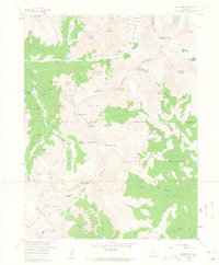
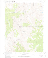
1958 Map of Montezuma
USGS Topo · Published 1963About this map
Montezuma sits at the heart of this high-elevation mining district, surrounded by the peaks of the Arapaho National Forest and Pike National Forest. The landscape is a dense network of late-19th and early-20th-century claims, illustrating the intense extraction efforts along the Continental Divide. Numerous operations such as the American Eagle Mine, Cashier Mine, and Star of the West Mine are mapped alongside geographic landmarks like Webster Pass and Radical Hill. This survey highlights the complex drainage patterns of the Snake River and the North Fork South Platte River, and documents the path of the Roberts Tunnel as it traverses the mountain range. The map serves as a vital record for tracing old pack trails and mine locations that were central to the region's silver and lead production.
Find a feature on this map
89 named features on this map. Tap any name to fly to it.
Don’t see what you’re looking for? This feature index may not catch every label — zoom into the map to look around manually.
Map Details
Editions of this 1958 Montezuma Map
5 editions found
Other maps of this area

1903 · Georgetown
USGS Topo · 1:62,500

1905 · Georgetown
USGS Topo · 1:62,500

1924 · Montezuma
USGS Topo · 1:62,500

1926 · Montezuma
USGS Topo · 1:62,500

1933 · Montezuma
USGS Topo · 1:62,500

1937 · Como
USGS Topo · 1:62,500

1945 · Mount Logan
USGS Topo · 1:24,000

1948 · Mount Logan
USGS Topo · 1:24,000

1953 · Denver
USGS Topo · 1:250,000

1957 · Denver
USGS Topo · 1:250,000