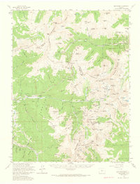
1958 Map of Montezuma
USGS Topo · Published 1966About this map
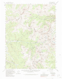
Continental Divide summits dominate this mid-century look at the high-alpine mining districts surrounding the Snake River. The map captures a landscape of intense extraction, where deep tunnels and high-altitude workings like the Santiago Mine and Pennsylvania Mine reached into the silver-bearing veins of the Front Range. While many of the primary towns had already peaked, the map records the remaining structures at Saints John and Swandyke, alongside active mountain infrastructure like the Roberts Tunnel and the Loveland Pass Tunnel. In the northern sections, the transition from industrial mining to recreation is evident with the established Loveland Ski Area and Arapahoe Basin Ski Area. This survey provides critical data for genealogists and researchers tracking the specific locations of dozen of named mines, including the Stevens Mine and the remote Waldorf Mine.
Find a feature on this map
180 named features on this map. Tap any name to fly to it.
Don’t see what you’re looking for? This feature index may not catch every label — zoom into the map to look around manually.
Map Details
Editions of this 1958 Montezuma Map
5 editions found
Other maps of this area

1889 · Leadville
USGS Topo · 1:125,000

1891 · Leadville
USGS Topo · 1:125,000

1903 · Georgetown
USGS Topo · 1:62,500

1905 · Central City
USGS Topo · 1:62,500

1905 · Georgetown
USGS Topo · 1:62,500

1910 · Central City
USGS Topo · 1:62,500

1912 · Central City
USGS Topo · 1:62,500

1924 · Montezuma
USGS Topo · 1:62,500

1924 · Fraser
USGS Topo · 1:62,500

1926 · Fraser
USGS Topo · 1:62,500